
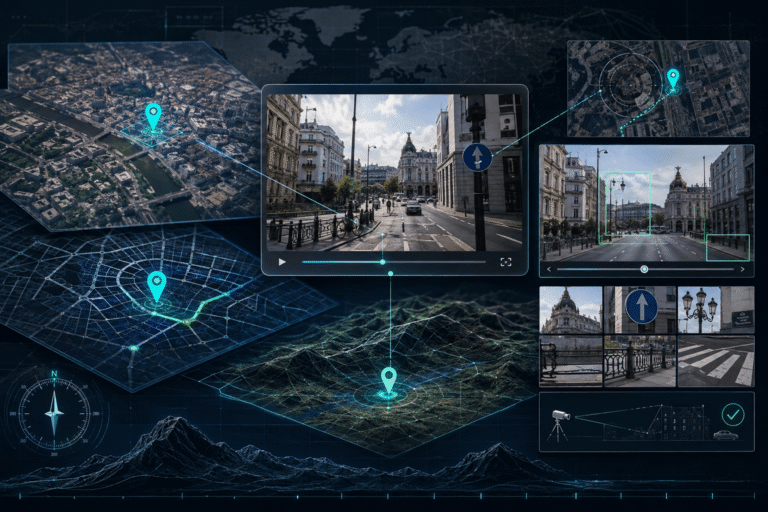
Video geolocation is the process of determining where footage was recorded by matching clues inside the video to a real place. Those clues can include street signs, road geometry, buildings, transit systems, mountains, coastlines, utility poles, storefronts, vegetation, skylines, and the relative position of objects in the scene.
The strongest geolocation does not stop at “this looks like Berlin” or “the language is Spanish.” It builds a location hypothesis, tests that hypothesis against maps and ground-level imagery, looks for several independent matches, and actively searches for contradictions. A precise match should explain the scene’s geometry, not merely resemble it.
What Is Video Geolocation?
Video geolocation is an open-source verification method for identifying the real-world location shown in footage.
The goal is not simply to recognize a landmark. In many investigations, there is no famous landmark at all. The location may be established from a combination of ordinary features: a curved road, a mosque, a row of low buildings, a mountain ridge, a bus-stop design, and the direction in which those features appear from the camera.
Bellingcat’s foundational guide to geolocating video demonstrates exactly this approach: identify landmarks and road geometry inside the footage, form a candidate location, then compare the road layout and surrounding features against map imagery until the scene can be confirmed. See Bellingcat’s guide to geolocating videos.
Video Geolocation Is Not GPS Metadata
Video geolocation and GPS metadata can point to the same answer, but they are different evidence types.
| Method | What it uses | Main limitation |
|---|---|---|
| Visual video geolocation | Scene content, road layout, landmarks, terrain, text, maps and sightlines | Can be difficult when the scene is generic or poorly visible |
| GPS metadata | Coordinates or location fields stored with the file | May be absent, stripped, regenerated or edited |
| Source geolocation | Uploader profile, caption, account history or linked source | The uploader may not be at the location shown |
If your file contains GPS or device information, interpret it as supporting evidence and compare it with the visible scene. The video metadata guide explains how location fields should be read without treating them as self-authenticating proof.
Geolocation Is Also Different From Chronolocation
Geolocation answers where. Chronolocation answers when.
The two often support each other. Once you know the exact street, historical Street View can show when a storefront changed. Once you know the likely date, seasonal conditions or construction may help distinguish two otherwise similar locations.
But keep the claims separate. A correct location does not prove the claimed date. If the central question is when the footage was recorded, use the video timestamp and chronolocation guide.
The Location Proof Loop
A reliable geolocation investigation repeatedly moves through four stages:
- Candidate
- Use text, landmarks, road systems, language, terrain or source context to generate one or more plausible places.
- Match
- Compare the candidate against maps, Street View, satellite imagery, photographs and other location references.
- Contradiction
- Look for something that should be visible but is missing, or a road, building, mountain or orientation that does not fit.
- Confidence
- Keep the candidate only when several independent features match and important expected features do not conflict.
This is stronger than collecting clues that only confirm your first guess. Geolocation is vulnerable to confirmation bias because many cities share similar buildings, roads, vegetation and signs.
Step 1: Preserve the Claim Before Studying the Map
Write down what the video is claimed to show:
- city
- country
- specific building or street
- event
- date if relevant
- source account
Do not let the caption silently become evidence. Treat it as a hypothesis.
If a post says “downtown Kyiv,” your task is not to prove Kyiv. Your task is to determine whether the visible scene independently supports Kyiv better than competing locations.
Step 2: Turn the Video Into Location Evidence
Watch the entire clip before choosing frames. A weak opening shot may be followed by a one-second view containing the decisive clue.
Prioritize frames that show:
- street names
- storefront text
- intersections
- building facades
- transit stops
- mountain or coastline profiles
- road markings
- utility infrastructure
- multiple landmarks in the same view
The video frame extractor guide explains how to choose frames with high information density rather than exporting hundreds of adjacent images.
Step 3: Build a Clue Inventory Before Searching
Separate what you observe from what you infer.
| Observed | Inference to test |
|---|---|
| Vehicles drive on the left | Country likely uses left-hand traffic |
| Sign uses Cyrillic script | Location may be in one of several Cyrillic-using regions |
| Blue tram with a specific logo | Transit operator may identify the city |
| Dry mountains rise directly behind dense housing | Terrain can narrow the candidate region |
This prevents vague impressions from becoming facts too early.
Text Is Often the Fastest Route to a Candidate Location
Readable text can collapse a worldwide search into a single neighborhood.
Look for:
- street names
- business names
- phone-number formats
- website domains
- transit stop names
- parking signs
- government logos
- school or hospital names
Search the most specific phrase rather than a generic word. A unique pharmacy name plus a district name is more valuable than identifying only the language.
Language itself is a regional clue, not a country verdict. Multilingual cities, minority languages, tourism and imported signs can all mislead.
Use Google Lens to Identify or Search a Visual Clue
If a frame contains a building, monument, logo, storefront or distinctive object, image search can generate candidate locations.
Google’s current Lens documentation says image-search results can include objects found in the image, similar images, and websites containing the same or a similar image. It also supports selecting a smaller region when one part of the frame is more useful. See the Google Lens image-search documentation.
Use the match as a lead. A visually similar building in search results still needs geographic confirmation.
Road Geometry Is Often Stronger Than Architecture Style
Architecture can suggest a region, but road geometry can identify a specific place.
Compare:
- intersection type
- road curvature
- number of lanes
- median width
- roundabouts
- service roads
- bridge approaches
- side-street angles
- relative spacing between junctions
Bellingcat’s classic geolocation example demonstrates how the shape and curvature of roads, together with a mosque and open areas, can narrow an otherwise visually generic scene to a precise filming location.
Traffic Direction and Road Markings Narrow the Search
Traffic clues are especially useful for regional elimination.
Inspect:
- left-hand or right-hand traffic
- center-line color and pattern
- edge markings
- crosswalk design
- traffic-light placement
- sign shapes
- lane arrows
- curb paint
Do not use one road marking as definitive country identification. Neighboring countries can share standards, and markings can change over time.
Public Transport Can Be a City-Level Fingerprint
Buses, trams, metro entrances and taxi fleets often contain highly local information.
Useful features include:
- operator logo
- vehicle color scheme
- route number
- stop design
- overhead tram wiring
- platform architecture
- fleet model
A route number plus a recognizable street can sometimes establish not only the city but the exact corridor.
Utility Poles, Street Furniture and Infrastructure Are Underrated Clues
Generic urban scenes often become distinctive when you stop looking only at buildings.
Compare:
- power poles and crossarms
- streetlights
- guardrails
- bollards
- fire hydrants
- bus shelters
- trash containers
- roadside drainage
- utility cabinets
These are useful because municipal and national infrastructure tends to repeat within a region.
Terrain Can Eliminate Entire Cities
Mountains, ridgelines, coastlines, rivers and plains provide large-scale geometry that is difficult to fake accidentally.
Ask:
- How close is the terrain to the camera?
- Which direction does the ridge run?
- Are peaks isolated or continuous?
- Does the road descend toward water?
- Is the skyline blocked by a slope on one side only?
A mountain that merely “looks similar” is weak. A ridge profile that appears in the correct direction behind correctly matched streets is much stronger.
Step 4: Generate Candidates, Then Stop Searching Globally
Once you have a plausible city or district, change tactics.
Do not keep searching the entire web for more vague similarities. Move to local map confirmation.
Useful candidate-generation evidence might be:
- a unique business name
- a city-specific tram operator
- a recognizable landmark
- a road sign containing a district name
- a source account tied to a small area
Then try to break the candidate with geometry.
Step 5: Confirm the Candidate With Street View
Google Street View is especially useful because it lets you compare the camera-level scene with ground-level reference imagery.
Google’s current Maps documentation also supports viewing older Street View imagery where available through See more dates. Historical coverage is not available everywhere. See the Google Street View documentation.
Do not compare only the obvious landmark. Match the surrounding scene:
- building order
- window patterns
- road width
- tree positions
- side streets
- utility poles
- terrain behind the buildings
A strong match should survive rotation and wider context.
Street View Date Matters
A mismatch between a video and Street View does not automatically eliminate the location.
The reference imagery may be older or newer than the video. A store can close, trees can grow, buildings can be renovated, roads can be resurfaced and billboards can change.
When available, compare multiple Street View dates before calling a candidate wrong.
Satellite Imagery Solves Problems Street View Cannot
Satellite imagery is stronger for overhead geometry:
- road networks
- building footprints
- courtyards
- parking lots
- rivers
- rail lines
- industrial facilities
- large walls and compounds
A video filmed from a rooftop or hillside may be easier to solve from building geometry and sightlines than from street-level imagery.
Sightline Geometry Can Pinpoint the Camera Position
Once several visible objects have been identified on a map, their relative directions can constrain where the camera was standing.
Suppose the video shows:
- a water tower slightly left of a warehouse
- a tall building behind both
- a road crossing the view at a known angle
Candidate camera positions that reverse the order of those landmarks can be rejected even if the neighborhood looks similar.
In a recent Bellingcat investigation, analysts geolocated video by identifying buildings, trees and a water tower, then tracing sightlines against satellite imagery to determine the likely camera position. The case illustrates why relative geometry can be more decisive than visual resemblance. See the Bellingcat sightline geolocation example.
Perspective Is Evidence
A correct map location can still produce the wrong camera viewpoint.
Check:
- which landmark overlaps another
- how much of a building side is visible
- relative apparent height
- vanishing direction of the road
- foreground and background ordering
- whether the camera appears above, below or level with a feature
These perspective relationships help distinguish “same area” from “same filming point.”
Moving Videos Give You Parallax
A moving camera creates extra information.
Nearby objects shift across the frame faster than distant features. As a vehicle turns or the camera walks down a street, buildings, poles and mountains change relative position.
This motion can help reconstruct:
- travel direction
- which side of the road the camera occupies
- the sequence of intersections
- which landmark is closer
- the likely route through the mapped area
A single still may fit several places. A ten-second route through three intersections can be unique.
Negative Evidence Is Part of Geolocation
Strong investigators ask what should be visible if the candidate is correct.
Example: A candidate street matches a church, road curve and storefront. But satellite imagery shows a six-story apartment block directly behind the camera’s line of sight, and the video clearly shows open sky there.
That missing structure is evidence against the candidate.
Contradictions deserve more weight than weak similarities.
Do Not Let Architecture Become a Stereotype
Statements such as “this looks Eastern European” or “this architecture looks Mediterranean” can be useful for broad candidate generation, but they are weak evidence for confirmation.
Building styles travel. Cities contain imported styles. New developments can look similar across countries.
Use architecture together with road geometry, signs, transport, terrain and mapped relationships.
License Plates Are Useful, but Often Overrated
Plate shape, color and layout can narrow a region, but video often lacks enough resolution to read a plate reliably.
Compression and motion blur can change apparent characters. Some jurisdictions share similar formats. Privacy blurring can remove the clue entirely.
Treat plate format as one clue unless the plate is genuinely readable and independently verifiable.
When Reverse Search Finds the Location for You
Sometimes geolocation does not require manual map work because the same frame already exists online with location context.
Reverse searching several distinctive frames may reveal:
- an older news report naming the place
- a tourism photo of the same building
- a previous upload from the same street
- an event page tied to the venue
That source still needs verification, but it can convert an open-ended geolocation problem into a candidate-confirmation problem. The reverse video search guide covers that source-tracing workflow.
Geolocating Rural and Featureless Video
Rural scenes can be harder because there are fewer named objects.
Shift attention to:
- road construction
- field boundaries
- irrigation
- utility lines
- soil and vegetation
- mountain profiles
- river bends
- railways
- isolated towers or industrial structures
Bellingcat investigations have shown that even field color, furrow direction and a small number of reference structures can become useful when matched systematically against satellite imagery.
Geolocating Indoor Video
Indoor footage requires a different strategy because public map geometry is usually unavailable.
Look for:
- venue branding
- logos
- menus
- conference banners
- room layout
- window views
- artwork
- architectural details
Then search venue photos, property listings, event galleries or official pages. A unique ceiling, staircase or window arrangement can sometimes identify a room.
Three Geolocation Cases
Case 1: City identified from transit and road geometry
A video shows a blue tram, a route number, a triangular junction and a curved boulevard. The operator’s branding identifies a likely city. The route map narrows the corridor. Street View then confirms the junction shape, building order and tram wiring.
Conclusion: several independent features support the same street location.
Case 2: Landmark match fails the geometry test
A tower in the video resembles a well-known landmark. Image search produces a candidate city. However, from every plausible nearby road, the mountain ridge should appear to the left of the tower, while the video shows it on the right.
Conclusion: the visual resemblance is insufficient and the candidate should be rejected.
Case 3: GPS and visual evidence agree
An original file contains coordinates. The coordinates place the camera beside a roundabout. Street View shows the same road markings, low wall and storefront order, and satellite imagery matches the road angle.
Conclusion: GPS and independent visual geolocation converge, producing a stronger location finding than either source alone.
A Location Evidence Matrix
| Evidence | Useful for | Main caution |
|---|---|---|
| Exact street or business name | Generating a narrow candidate | Branches and duplicate names exist |
| Road geometry | Confirming a precise mapped area | New construction may change roads |
| Street View match | Ground-level confirmation | Imagery date may differ from the video |
| Terrain profile | Regional and directional confirmation | Perspective can distort apparent shape |
| Transit branding | City or corridor identification | Vehicles can travel outside normal service areas |
| GPS metadata | Direct coordinate lead | Ordinary metadata is not tamper-evident |
| Source caption | Generating a hypothesis | It is a claim, not independent proof |
How Much Evidence Is Enough?
There is no universal numeric threshold. The quality and independence of the matches matter more than the count.
A single readable street sign plus a perfect street-level geometry match may be stronger than ten vague clues about architecture and climate.
Use a confidence model based on evidence independence:
- Candidate only
- One clue suggests a location, but the scene has not been mapped or independently matched.
- Probable
- Several clues point to the same area and no major contradiction has been found.
- Strongly supported
- Distinct independent features, map geometry and viewpoint relationships align with the candidate.
- Exact filming point supported
- The camera position or route can be reconstructed from mapped features and sightlines with no material contradiction.
A Practical Video Geolocation Workflow
- Define the claimed place. Treat the caption as a hypothesis, not evidence.
- Watch the full video. Identify moments with the highest location information.
- Extract diverse frames. Preserve signs, intersections, landmarks, terrain and route changes.
- Build a clue inventory. Separate direct observations from inferences.
- Generate candidates. Use text, visual search, transit, terrain and source context.
- Move to map confirmation. Test road layout, buildings, Street View and satellite geometry.
- Reconstruct viewpoint. Check sightlines, landmark order, perspective and travel direction.
- Search for contradictions. Ask what should be visible if the candidate is correct.
- Cross-check metadata if available. Use coordinates as supporting evidence, not the only evidence.
- Separate place from time. Verify the recording date independently when it matters.
- Write the narrowest defensible location verdict.
Where DetectVideo AI Fits
DetectVideo AI can contribute technical analysis when the unresolved question concerns the video file or media itself, such as possible AI generation, manipulation, temporal anomalies, compression or metadata.
It should not replace external geolocation. A technical detector cannot independently know that two roads intersect in a particular district or that a mountain should appear behind a building from a specific camera position.
For a complete investigation that combines source, place, time, provenance and media integrity, use the video verification workflow.
Use Precise Geolocation Verdicts
| Verdict | Meaning |
|---|---|
| Exact filming location supported | Mapped scene geometry and multiple independent features support a specific camera position or route |
| Location strongly supported | Several independent features align with the claimed area, although the exact camera point is not established |
| Candidate location | Evidence suggests a place but important confirmation is still missing |
| Claimed location contradicted | Mapped or visible evidence conflicts materially with the stated location |
| Location unverified | The available footage does not contain enough reliable location evidence |
Key Takeaway
Video geolocation is a geometry problem as much as a recognition problem.
Use signs, text, transit, roads, buildings and terrain to generate candidate locations. Then stop guessing and test the candidate against maps, Street View, satellite imagery, sightlines and perspective. Look for contradictions deliberately.
The best result is not “this looks like the city.” It is an explanation of why several independent features occupy the correct places and directions from the camera’s viewpoint.
FAQ About Video Geolocation
How can I find where a video was filmed?
Extract clear frames, identify distinctive text, roads, landmarks, transport, buildings and terrain, use those clues to generate candidate locations, then confirm the scene with maps, Street View, satellite imagery and viewpoint geometry.
Can I geolocate a video without GPS metadata?
Yes. Most open-source video geolocation relies on visible scene evidence rather than GPS. Road layouts, signs, buildings, mountains, transit and sightlines can establish location even when metadata is absent.
Can GPS metadata prove where a video was filmed?
GPS coordinates can be strong supporting evidence, especially in an original file, but ordinary metadata can be removed or edited. Compare the coordinates with the visible scene before treating them as confirmed location evidence.
Can Google Lens find where a video was recorded?
Sometimes. Searching a distinctive video frame or a cropped landmark can reveal similar images, websites or known locations. The result should be treated as a candidate and confirmed with map evidence.
How is Street View used for video geolocation?
Street View lets you compare ground-level features such as building order, road width, storefronts, intersections, poles and terrain with the video. Historical Street View can also explain changes between the reference image and the footage.
What are the best clues for video geolocation?
Exact text, unique landmarks, road geometry, transit branding, building relationships, terrain and multiple features visible in the same frame are usually stronger than broad clues such as architecture style or climate.
Can shadows tell where a video was filmed?
Shadows can support camera orientation and help test a location when the sun direction and scene geometry are known, but they are rarely sufficient to identify a place by themselves.
What if the video shows only a rural road?
Use road construction, field boundaries, power lines, soil, vegetation, mountain profiles, railways, rivers and isolated structures. Satellite imagery becomes especially important in low-information rural scenes.
What is the difference between geolocation and chronolocation?
Geolocation determines where media was recorded. Chronolocation estimates when it was recorded. They can support each other but should be reported as separate findings.